|
Previous planning documents such as the Corridor Plan for Perth (1970) and the North West Corridor Plan (1976) had clearly shown the Study Area in the main as required for future urban development. In 1987 a Government group reviewing the Corridor Plan recommended that a more compact urban form could be achieved by: - more dwellings within existing suburbs;
- residential use of land in the 'rural wedges';
- use of smaller lots in new suburbs.
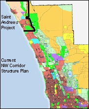
It became clear that these strategies would take considerable time to implement, given the attitudes of the people affected. Nevertheless, the 1987 report was the first comprehensive treatment of the economic, social and environmental issues for regional planning in Perth since the Corridor Plan was formulated in the late 1960s. The review group made a thorough analysis of regional resources. They recommended a major arc of parkland and conservation reserves from Whiteman Park through Gnangara and Wilbinga to the coast. This concept includes offshoots to the Yanchep and Neerabup National Parks, and the Wanneroo lake system. The concept has been reflected in the Yanchep Structure Plan presented on this Site. The North West Corridor Structure Plan is currently being reviewed by the Department for Planning and Infrastructure in response to rapid growth in the North West Corridor. This growth has immediate implications for St Andrews in respect of residentail, retail, commercial and industrial development. The revised North West Corridor Structure Plan includes the latest concept plan for the St Andrews area. 
|
 NW Corridor Structure Plan
  NW Corridor Structure Plan
  NW Corridor Structure Plan